Orographic precipitation:

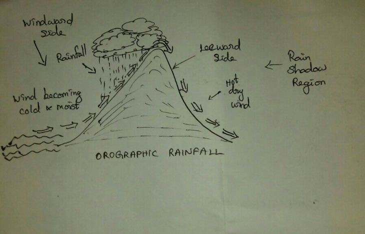
It occurs when a current of moist air flows upward and over a mountainous barrier. The term orographic means “related to mountains.” To understand the orographic precipitation process, think of what hap-pens to a mass of air moving up and over a mountain range. As the moist air is lifted, it is cooled, and condensation and rainfall occur. Passing over the mountain summit, the air descends the leeward slopes of the range, where it is compressed and warmed. Because the air is much warmer and much drier than when it started, little precipitation occurs in these regions, producing a rain shadow on the far side of the mountain.
CONVECTIVE PRECIPITATION
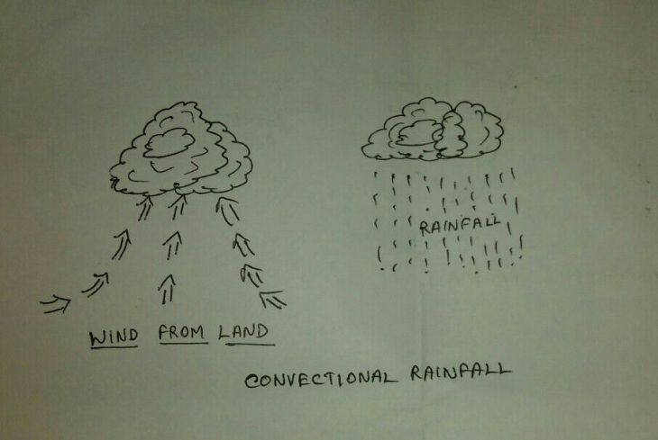
Air can also be forced upward through convection, leading to convective precipitation . In this process, strong updrafts occur within convection cells, vertical columns of rising air that are often found above warm land surfaces. Air rises in a convection cell because it is warmer, and therefore less dense, than the surrounding air.
The convection process begins when a surface is heated unequally. Think of an agricultural field surrounded by a forest, for example. The field surface is largely made up of bare soil with only a low layer of vegetation, so under steady sunshine the field will be warmer than the adjacent forest. This means that as the day progresses the air above the field will grow warmer than the air above the forest.

The density of air depends on its temperature; warm air is less dense than cooler air. The hot-air balloon operates on this principle. The balloon is open at the bottom, and in the basket below, a large gas burner forces heated air into the balloon. Because the heated air is less dense than the surrounding air, the balloon rises. The same principle will cause a bubble of air to form over the field, rise, and break free from the surface, as in Figure.
As the bubble of air rises, it is cooled adiabatically;
Its temperature will decrease as it rises, according to the dry or moist adiabatic lapse rate. The temperature of the surrounding air will normally decrease with altitude as well, but at the environmental lapse rate.
For convection to occur, the temperature of the air bubble must be warmer than the temperature of the surrounding atmosphere, even as it rises. When the sur-rounding air is stable , the temperature of the air bubble rapidly reaches the temperature of the surrounding air, and the bubble loses its buoyancy. The uplift stops.
This means that the environmental temperature must decrease more rapidly with altitude than the rising air parcel ’s temperature.
FRONTAL / CYCLONIC PRECIPITATION
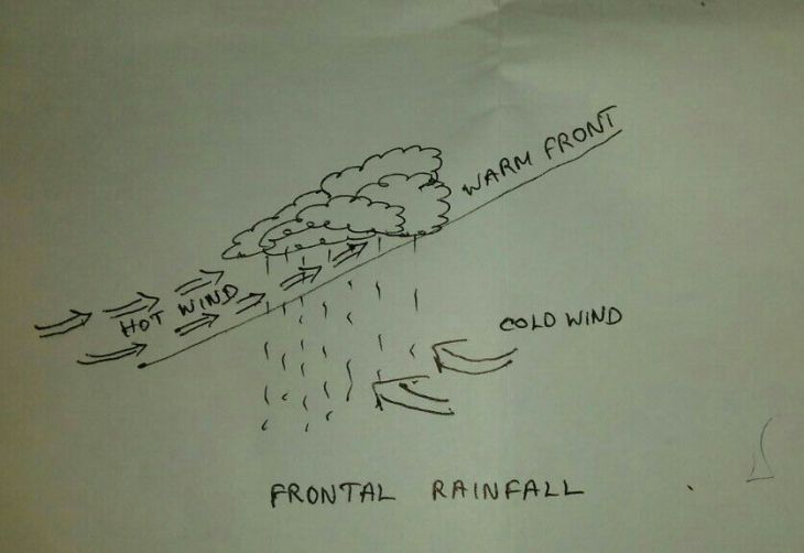
It occurs due to upward movement of air caused by convergence of cold air masses against warm air masses.

CYCLONIC PRECIPITATION
When the air is caused to rise upwards due to cyclonic circulation, the resulting precipitation is called cyclonic rainfall. The average weather conditions over a large area are called the climate of a place.The factors which control the weather and the climatic conditions are latitude, altitude, unequal distribution of land and water,ocean current, air pressure and wind,mountain barrier, nature of ground surface,different types of atmospheric storms etc.