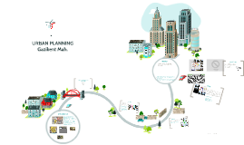
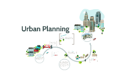
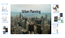
You're about to create your best presentation ever

Free Powerpoint Templates Urban Planning

Create your presentation by reusing a template from our community or transition your PowerPoint deck into a visually compelling Prezi presentation.

URBAN PLANNING

Transcript: Introduction GAZIKENT MAIN ENTRANCE A node is a focus point for orientation like squares, junctions, focal points and intersections. PATHS *Gazikent is an area where the majority of the cooperative. *The city center is 12 km away. Its 30 minutes with the bus. *Population is around the 40.000 people *Education level of this region; %10 of university, %30 high school, %30 of secondary school and the part of %30 primary school graduates. *Generally, there are health centers. But now, there is a big hospital construction which going construction. *Green areas are little according to region. There are only small parks. *Axles very smooth and aligned. *Soil, very suitable for making building because of component.(limestone) *Houses are usually square or rectangular. They made on shaped plot. **The only region where zoning according to buildings. *There are 2-3 and 5 floor buildings in this area. *Apartment prices usually start from 80.000TL and go up to 250.000TL. *There are industrial sites around the area. *Transportation providing by bus or personal cars. URBAN PLANNING Gazikent Mah. NODES A GENERAL PERSPECTIVE VIEW OF THE NEIGHBORHOOD 1- DISTRICT 2- LANDMARKS 3- PATHS 4- NODES 5- EDGES MASS AND VOID design by Dóri Sirály for Prezi Path is a track made by people or animals walking over the ground The area in front of someone or something that is moving It is a way from one place to another that people can walk along it is a connection between areas Paths are the circulation of the city refers to the way people move through and interact with buildings PARTITION AND DIVISION OF THE AREA Landmarks Space can be either full or empty A void is an empty volume, while a mass is a filled volume. Voids and masses can be referred to as: Negative space/ Positive space Negative form/Positive form Volume/Solid or Space/Form A landmarks is an object or structure on land that is easy to see and recognize DISTRICT In gazikent, the nodes and focal points and the round about. There is on the entrance of gazikent, and on each street to divide the district and to show the orientations. There is the big nodes, on the main street, and we can find the small nodes on the secondary street. they are from the most important to the least. It is also a building or place that was important in history THE MAIN 5 ELEMENTS OF A MAP BY KEVIN LYNCH A District is an area established by a government for official government business. it is also a section that has some special characteristic or purpose the width of the streets main street 20 M secondary streets 7 M primary streets 15 M in gazikent, the characteristics of the divided area, are the zonning of the mahalesi. Each zone as e can see, has a shape of building, has a different character, are made of different material, and also different size. GAZIKENT AREA

PowerPoint Game Templates

Transcript: Example of a Jeopardy Template By: Laken Feeser and Rachel Chapman When creating without a template... http://www.edtechnetwork.com/powerpoint.html https://www.thebalance.com/free-family-feud-powerpoint-templates-1358184 Example of a Deal or No Deal Template PowerPoint Game Templates There are free templates for games such as jeopardy, wheel of fortune, and cash cab that can be downloaded online. However, some templates may cost more money depending on the complexity of the game. Classroom Games that Make Test Review and Memorization Fun! (n.d.). Retrieved February 17, 2017, from http://people.uncw.edu/ertzbergerj/msgames.htm Fisher, S. (n.d.). Customize a PowerPoint Game for Your Class with These Free Templates. Retrieved February 17, 2017, from https://www.thebalance.com/free-powerpoint-games-for-teachers-1358169 1. Users will begin with a lot of slides all with the same basic graphic design. 2. The, decide and create a series of questions that are to be asked during the game. 3. By hyper linking certain answers to different slides, the game jumps from slide to slide while playing the game. 4. This kind of setup is normally seen as a simple quiz show game. Example of a Wheel of Fortune Template https://www.teacherspayteachers.com/Product/Wheel-of-Riches-PowerPoint-Template-Plays-Just-Like-Wheel-of-Fortune-383606 Games can be made in order to make a fun and easy way to learn. Popular game templates include: Family Feud Millionaire Jeopardy and other quiz shows. http://www.free-power-point-templates.com/deal-powerpoint-template/ Quick video on template "Millionaire" PowerPoint Games Some games are easier to make compared to others If users are unsure whether or not downloading certain templates is safe, you can actually make your own game by just simply using PowerPoint. add logo here References Example of a Family Feud Template PowerPoint Games are a great way to introduce new concepts and ideas You can create a fun, competitive atmosphere with the use of different templates You can change and rearrange information to correlate with the topic or idea being discussed. Great with students, workers, family, etc. For example: With games like Jeopardy and Family Feud, players can pick practically any answers. The person who is running the game will have to have all of the answers in order to determine if players are correct or not. However, with a game like Who Wants to be a Millionaire, the players only have a choice between answers, A, B, C, or D. Therefore, when the player decides their answer, the person running the game clicks it, and the game will tell them whether they are right or wrong.

Urban Planning

Transcript: Urban Planning The Purpose This project will be very helpful to the City of Vancouver since the land is already there with buildings they can use to make a new affordable place for people to live. It will for sure help the issue of not having enough reasonable homes for people to buy. By 2020 the City of Vancouver will be turning the Olympic Park and Olympic residential places into the Southeast False Creek which will have housing for anyone to live. In the area where the Olympics were held in 2010, the City of Vancouver is transforming it into a home for 12 000 - 16 000 people and will have six million square feet of development. There will be 5000 residential units, a grocery store, community center, childcare facilities, schools, parks and more. Southeast False Creek Proposal Vancouver is densely populated and available land is limited due to the geography of the area given it is surrounded by water and mountains. As such the cost of housing is very expensive. The City of Vancouver realizes the importance of affordable housing for social responsibility. They are developing this area of the city with this in mind and also incorporating environmental responsibility into the plans. Also, the Olympic area has so much to offer and wasn't being used since the Olympics so it will definitely help people looking for reasonable living. design by Dóri Sirály for Prezi Who is involved? The City of Vancouver wishes to makes these changes to Southeast False Creek. Also, LEED (Leadership in Energy and Enviromental Design) will be helping to make False Creek a eco friendly area. The Plan http://www.sfu.ca/sustainablevancouver/sefc/design/ http://www.vancouver.ca Why would this be helpful? By - Madi LeBlanc Map of the new neighborhood : My Sources The purpose of this project is to turn Southeast False Creek into a sustainable development. It features efficient energy solutions, high performance green buildings and easy transit access.

Urban Planning

Transcript: Grid City Layout http://maps.google.com/maps/ms?hl=en&gl=us&ie=UTF8&oe=UTF8&msa=0&msid=209011466002072237499.0004b6e2e6d75cfcd298e History Basilica AskJeeves. “Urban planning.” Dictionary.com. http://dictionary.reference.com/browse/urban+planning (accessed January 12, 2012). Boethius, Axel. Etruscan and Early Roman Architecture. 2nd ed. Harmondsworth: Penguin, 1978. City of Chicago.org. “Explore Chicago: The City of Chicago’s Official Tourism Site.” Explore Chicago.org. www.explorechicago.org (accessed January 14, 2012). Dilke, O.A.W. The Roman Land Surveyors: An Introduction to the Agrimensores. Newton Abbot: David & Charles, 1971. Google Images. “Chicago Aerial Photo.” http://www.google.com/imgres?hl=en&gbv=2&biw=1280&bih=699&tbm=isch&tbnid=zlkrt4DXSMMs-M:&imgrefurl=http://www2.loras.edu/college/maps/&docid=ppaSQrPg9SlzHM&imgurl=http://www2.loras.edu/college/maps/statemap-large.jpg&w=691&h=631&ei=PHQYT_GxAcmLgwe277XmCw&zoom=1&iact=hc&vpx=379&vpy=279&dur=120&hovh=215&hovw=235&tx=122&ty=146&sig=100305249962717565629&page=3&tbnh=143&tbnw=157&start=37&ndsp=22&ved=1t:429,r:17,s:37 (accessed January 18, 2012). Google Images. “Dubuque Aerial Photo.” http://www.google.com/imgres?hl=en&gbv=2&biw=1280&bih=699&tbm=isch&tbnid=zlkrt4DXSMMs-M:&imgrefurl=http://www2.loras.edu/college/maps/&docid=ppaSQrPg9SlzHM&imgurl=http://www2.loras.edu/college/maps/statemap-large.jpg&w=691&h=631&ei=PHQYT_GxAcmLgwe277XmCw&zoom=1&iact=hc&vpx=379&vpy=279&dur=120&hovh=215&hovw=235&tx=122&ty=146&sig=100305249962717565629&page=3&tbnh=143&tbnw=157&start=37&ndsp=22&ved=1t:429,r:17,s:37 (accessed January 18, 2012). Google Images. “Roman Arches.” http://www.google.com/imgres?hl=en&gbv=2&biw=1280&bih=699&tbm=isch&tbnid=LdMkW1OiDcRW7M:&imgrefurl=http://quizlet.com/4587751/roman-arch-flash-cards/&docid=cdVJebY_nN0TTM&imgurl=http://farm6.static.flickr.com/5204/5261867773_cddf640848.jpg&w=500&h=292&ei=gXIYT6bXLsiggwevjPHaCw&zoom=1&iact=rc&dur=550&sig=100305249962717565629&page=10&tbnh=129&tbnw=221&start=184&ndsp=21&ved=1t:429,r:7,s:184&tx=87&ty=75 (accessed January 18, 2012). Google Maps. http://maps.google.com/maps/ms?hl=en&gl=us&ie=UTF8&oe=UTF8&msa=0&msid=209011466002072237499.0004b6e2e6d75cfcd298e (accessed January 18, 2012). Google Maps. http://maps.google.com/maps/ms?hl=en&gl=us&ie=UTF8&oe=UTF8&msa=0&msid=209011466002072237499.0004b6e2e6d75cfcd298e (accessed January 18, 2012). Nash, Ernest. Roman Towns: Photographs and Text. New York, NY: J.J. Augustin, 1944. Oleson, John Peter. Greek and Roman Mechanical Water-Lifting Devices. Toronto, Ont., CAN: University of Toronto Press, 1984. Rogers, Elizabeth Barlow. Landscape Design: A Cultural and Architectural History. New York, NY: Harry N. Abrams, Inc., 2001. Surewest. “Roman Forum.” Surewest. http://home.surewest.net/fifi/index50.html (accessed January 18, 2012) Wheeler, Mortimer. Roman Art and Architecture. New York, NY: Thames and Hudson Inc., 2005. Wikitravel. “Chicago/Loop.” http://wikitravel.org/en/Chicago/Loop#b (accessed January 15, 2012). http://www.google.com/imgres?hl=en&gbv=2&biw=1280&bih=699&tbm=isch&tbnid=LdMkW1OiDcRW7M:&imgrefurl=http://quizlet.com/4587751/roman-arch-flash-cards/&docid=cdVJebY_nN0TTM&imgurl=http://farm6.static.flickr.com/5204/5261867773_cddf640848.jpg&w=500&h=292&ei=gXIYT6bXLsiggwevjPHaCw&zoom=1&iact=rc&dur=550&sig=100305249962717565629&page=10&tbnh=129&tbnw=221&start=184&ndsp=21&ved=1t:429,r:7,s:184&tx=87&ty=75 http://www.google.com/imgres?hl=en&gbv=2&biw=1280&bih=699&tbm=isch&tbnid=zlkrt4DXSMMsM:&imgrefurl=http://www2.loras.edu/college/maps/&docid=ppaSQrPg9SlzHM&imgurl=http://www2.loras.edu/college/maps/statemaparge.jpg&w=691&h=631&ei=PHQYT_GxAcmLgwe277XmCw&zoom=1&iact=hc&vpx=379&vpy=279&dur=120&hovh=215&hovw=235&tx=122&ty=146&sig=100305249962717565629&page=3&tbnh=143&tbnw=157&start=37&ndsp=22&ved=1t:429,r:17,s:37 Urban Planning noun 1.the branch of architecture dealing with the design and organization of urban space and activities 2.determining and drawing up plans for the future physical arrangement and condition of a community Market Curia Building around water Chicago Dubuque Apenine, Mycenaean, and Etruscan villages became centers for improved faming and metal-mining Unification (collaboration) and technological improvements Iron Age huts and hamlets from wattle and daub Geometric age influence Furrow ploughing where the city would be (Etruscan) Proper town has three gates and three main streets (Etruscan) Fortification/hillside settlements Can’t overlook Hellenestic elements Role of large avenues Role of private and public interaction in creating projects (e.g. Caesar’s engineers building over a bridge over the Rhine) Skilled at surveying, map-making, and visionaries Role of tourism (both ancient and contemporary) Pompeii’s importance in understanding the planning and implementation Roads (dating back to Bronze age and Paleolithic times) Changing uses dictionary.com Sources

Urban Planning

Transcript: Bad Urban Planning- Block D -Block D is a series of apartment buildings -They are located on Ontario street in Downtown Kingston -They are not good urban planning because they block the view to the water front which is one of Kingston's biggest attractions - When considering the building of block D, an expert designer suggested against it and said they should keep the waterfront accessible but they did the opposite -Multi use building -Stores on bottom, condos on top -Located in an area with lots of bus stops Image by Tom Mooring - Drive thru blocks traffic - Right infront of residents backyard -Bad parking space -Creates line ups and long waits Urban Sprawl -The uncontrolled expansion of urban areas Greenwood Park -Subdivision placed along a highway -Not much within walking distance -Have to rely on a car -Houses are packed together -Bad use of greenspace Stores/residencies Offices/gyms the branch of architecture dealing with the design and organization of urban space and activities -The Springer Market Square is located right behind city hall in the heart of downtown Kingston Good Urban Planning -Bike paths on all busy/frequently used streets Urban Planning -Urban sprawl is gobbling up green space in southern Ontario at an unprecedented rate Creates room for parks, schools, buisness buildings Wider streets Alternitive bike intersections -More town houses both down town and in the suburbs Tim Hortons in Porstmouth -Sprawling patterns destroy green space, pollute rivers, and force us to be overly dependent on vehicles - Urnan Planing in Kingston Good Urban Planning Bad Urban Planning -More multi use buildings, down town and in the outskirts of the city What Kingston Could Look Like! Springer Market Square Improving Kingston's Urban Planning -Used all seasons Bad Urban Planning Queensburry Plaza Free skating all winter, FebFest, market, movies in the square - Good for other downtown businesses -oldest market in Ontario and has been providing food and a sense of community to residents of Kingston since 1801 - Doesn't fit with the rest of neighbourghood

Urban Planning

Transcript: Human Geo 4th & 7th Prominent skyline/skyscrapers Negative Aspects What is Urban Planning ? Ex) Chicago Skyline Sears Tower (Willis Tower) John Hancock building Shantytown: a slum settlement where resident build "houses" or shacks out of any materials they can find Caused by rapid urbanization Typically built on the periphery of cities NOT built by urban planners The Spreading of urban developments, such as houses or shopping centers, on undeveloped land near a city. 1) Renowned Cultural Institutions Higher rate of pollution Higher rate of traffic accidents 3) Educational Institutions An advanced communications infrastructure Goal: Takeaway Problems w/ Urban Planning? A major international airport design by Dóri Sirály for Prezi City as a site/subject in arts, media, television, film, video games, music, literature, magazines, articles, documentary etc. 4) Tourism Urban Sprawl Shanty towns are rising in population around the world As of 2011 over 1 billion people live in slums today = 1/7 of the world's pop. Cultural Characteristics Contributes significantly financially to the city/state Houses the major stock market industry Provides a variety of international financial services High cost of living Infrastructural Characteristics Sites for pilgrimage for world religions and learning areas B/c those who live farther from the city tend to drive more Increase dependency on cars An advanced transportation system that includes several highway and or large mass transit network that includes multiple modes of transportation What is White Flight? Considered to be an important part of the global economic system. Globalization was largely created, facilitated and enacted in strategic locations How far away is your airport from the CBD? What problems might occur from that? How close is your airport from your homes? How close is your sewage plant to your homes? Do highways connect to the factories, CBD(s) and homes? How much traffic do you anticipate? How close are the schools (elementary, middle & high school) to the housing developments? Any problems do you anticipate with location? How close are factories to your low income housing? Etc. Etc. Etc.......... Shanty Towns/Slums Ex) CTA or Metra 1. What is Urban Planning? 2. Global Cities 3. Economic, Cultural, Infrastructural Characteristics 4. Urban Sprawl & White Flight 5. Shantytowns Concern with the orderly development of major cities, settlements & communities Including major sports facilities, home teams in major leagues Where white city-dwellers move to the suburbs to escape the influx of minorities. Started in the 1950's & 60's Global Cities What Role do Cities Play in the World? Serves as the corporate headquarters site for multinational corporations High Rates of : crime, suicide, drug use and disease. Recycling or shifting through garbage to survive. Shantytown Cont. Most residents live in single family homes and commute by car to their jobs in the city Good or Bad? Ex) O'Hare Illustrates positive growth of a local economy Typically a safer place to live and raise children Suburbs move at a slower pace & space is not in high demand Low Density population Wide streets & Large lawns Often do not have proper sanitation such as ..... Running water supply Electricity or telephone services No grid system Several influential media organizations with international reach. Economic Characteristics Single-use zoning Less efficient use of space Increased obesity Decrease in social capital "White Flight" Positives Aspects 2) Strong Sporting Communities Ex) Wi-fi networks Cell phone services High-speed lines of communication Urban Planning

Now you can make any subject more engaging and memorable