EP2492707A1 - Method for determining a map of an area associated to a base station - Google Patents
Method for determining a map of an area associated to a base station Download PDFInfo
- Publication number
- EP2492707A1 EP2492707A1 EP11156141A EP11156141A EP2492707A1 EP 2492707 A1 EP2492707 A1 EP 2492707A1 EP 11156141 A EP11156141 A EP 11156141A EP 11156141 A EP11156141 A EP 11156141A EP 2492707 A1 EP2492707 A1 EP 2492707A1
- Authority
- EP
- European Patent Office
- Prior art keywords
- terminal
- base station
- measurements
- probability distributions
- map
- Prior art date
- Legal status (The legal status is an assumption and is not a legal conclusion. Google has not performed a legal analysis and makes no representation as to the accuracy of the status listed.)
- Granted
Links
Images


Classifications
-
- G—PHYSICS
- G01—MEASURING; TESTING
- G01S—RADIO DIRECTION-FINDING; RADIO NAVIGATION; DETERMINING DISTANCE OR VELOCITY BY USE OF RADIO WAVES; LOCATING OR PRESENCE-DETECTING BY USE OF THE REFLECTION OR RERADIATION OF RADIO WAVES; ANALOGOUS ARRANGEMENTS USING OTHER WAVES
- G01S5/00—Position-fixing by co-ordinating two or more direction or position line determinations; Position-fixing by co-ordinating two or more distance determinations
- G01S5/02—Position-fixing by co-ordinating two or more direction or position line determinations; Position-fixing by co-ordinating two or more distance determinations using radio waves
- G01S5/0278—Position-fixing by co-ordinating two or more direction or position line determinations; Position-fixing by co-ordinating two or more distance determinations using radio waves involving statistical or probabilistic considerations
-
- G—PHYSICS
- G01—MEASURING; TESTING
- G01S—RADIO DIRECTION-FINDING; RADIO NAVIGATION; DETERMINING DISTANCE OR VELOCITY BY USE OF RADIO WAVES; LOCATING OR PRESENCE-DETECTING BY USE OF THE REFLECTION OR RERADIATION OF RADIO WAVES; ANALOGOUS ARRANGEMENTS USING OTHER WAVES
- G01S5/00—Position-fixing by co-ordinating two or more direction or position line determinations; Position-fixing by co-ordinating two or more distance determinations
- G01S5/02—Position-fixing by co-ordinating two or more direction or position line determinations; Position-fixing by co-ordinating two or more distance determinations using radio waves
- G01S5/0252—Radio frequency fingerprinting
- G01S5/02521—Radio frequency fingerprinting using a radio-map
- G01S5/02524—Creating or updating the radio-map
- G01S5/02527—Detecting or resolving anomalies in the radio frequency fingerprints of the radio-map
Definitions
- the present invention relates generally to a method and a device for determining a map of an area associated to a base station and for determining the location of a terminal.
- GNSS Global Navigation Satellite Systems
- Examples of these alternatives are those using the power or signal strength measured between the mobile terminal and several base stations.
- the signal strength is difficult to predict and may be modeled by a combination of path loss, large scale fading or shadowing and small scale fading.
- the small scale fading may be filtered out by averaging the signal over a time window or over the used bandwidth or by using multiple antennas.
- the shadowing is due to obstacles like buildings and hills in outdoor and wall and furniture in indoor. Shadowing depends on the position and obstacles like buildings hills and so on. If its value is not known, the accuracy of the geolocalization solutions based on signal strength can be drastically deteriorated.
- the present invention aims at determining a map of an area associated to a base station and at improving the determination of the location of a terminal using measurements on signals transferred by at least one base station of a wireless telecommunication network and received by the terminal or transferred by the mobile terminal and received by at least one base station.
- the present invention concerns a method for determining a map of an area associated to a base station, the map being composed of probability distributions associated to coefficients enabling the determination of shadowing values intended to determine the location of a terminal, the terminal receiving signals from the base station or the base station receiving signals from the terminal, characterised in that the method comprises the steps of:
- the present invention concerns also a device for determining a map of an area associated to a base station, the map being composed of probability distributions associated to coefficients enabling the determination of shadowing values intended to determine the location of a terminal, the terminal receiving signals from the base station or the base station receiving signals from the terminal, characterised in that the device comprises:
- the shadowing map may be used, for example, in order to improve the determination of the location of terminals.
- the present invention improves the accuracy of the coefficients.
- the given value is a predetermined value or depends on the area.
- the probability distributions associated to the coefficients are means and variances.
- probability distributions allows for applying Bayesian estimation techniques in updating these probability distributions and estimating the locations.
- the initial map is modeled by using a basis expansion method.
- Basis expansion is used in order to have a finite number of coefficients to deal with by keeping the dominant basis functions where a random coefficient is associated to a basis function.
- one map of the area associated to each of plural base stations is determined, the terminal receiving signals from the base stations or at least one base station receives signals from the mobile terminal, and one initial map is determined for each base station, measurements are received on power of signals transferred by the base stations and received by the terminal or transferred by the terminal and received by the base stations, probability distributions associated to coefficients of the maps of the base stations which correspond to the power measurements are obtained, probability distributions of the location are determined using the power measurements and positioning measurements, the variance of the determined probability distributions is compared to the given value and maps are updated if the variance of the determined probability distributions of the location is lower than the given value.
- the present invention takes into account possible correlation between different maps of different base stations which cover common areas.
- the initial map is determined only one time and in that, the obtaining steps, the probability distributions determination step, the checking and the updating steps are iteratively determined.
- the initial map provides a priori information.
- the iteration of the remaining steps allows for updating the shadowing maps based on measurements made over time by one or several terminals and thus improving the estimation of the maps and keeping them up-to-date.
- the probability distributions are determined from plural consecutive measurements on power and positioning measurements.
- the present invention takes into account possible correlation between different time periods.
- the present invention takes profit of the correlation between successive locations and measurements.
- the wireless telecommunication network is a wireless cellular telecommunication network.
- the shadowing map may be used, for example, in order to improve the determination of the location of mobile terminals.
- the present invention concerns a method for determining the location of a terminal in a wireless telecommunication network composed of at least one base station, a map of an area being associated to a base station, the map being composed of probability distributions associated to coefficients enabling the determination of shadowing values intended to determine the location of a terminal, the terminal receiving signals from the base station or the base station receiving signals from the terminal, characterised in that the method comprises the steps of:
- the present invention concerns also a device for determining the location of a terminal in a wireless telecommunication network composed of at least one base station, a map of an area being associated to a base station, the map being composed of probability distributions associated to coefficients enabling the determination of shadowing values intended to determine the location of a terminal, the terminal receiving signals from the base station or the base station receiving signals from the terminal, characterised in that the device comprises:
- the present invention concerns computer programs which can be directly loadable into a programmable device, comprising instructions or portions of code for implementing the steps of the methods according to the invention, when said computer programs are executed on a programmable device.
- the present invention also concerns an information storage means, storing a computer program comprising a set of instructions that can be run by a processor for implementing the aforementioned methods in any one of its various embodiments, when the stored information is read by a computer and run by a processor.
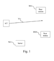
- Fig. 1 represents a wireless cellular telecommunication network in which the present invention is implemented.
- Fig. 1 base stations BS1 to BSN of a wireless telecommunication network are shown.
- the base stations BS1 to BSN are radiating and/or receiving signals that are received and/or transferred by a terminal MT which is moving according to a direction represented by the arrow Mvt.
- the base stations BS1 to BSN are linked to a server Serv by a backbone network which may be, for example, a DSL (Digital Subscriber Line) network or an ISDN (Integrated Services Digital Network).
- a backbone network which may be, for example, a DSL (Digital Subscriber Line) network or an ISDN (Integrated Services Digital Network).
- the base stations BS1 to BSN are named also access points of a local area network or when the wireless telecommunication network is a wireless cellular telecommunication network, home base stations, femto base stations or pico base stations or relays.
- the terminal MT may be a mobile terminal like a mobile phone, or a device like a femto base station which is installed in the premises of a user.
- the server Serv or at least one base station BS or the terminal MT :
- server Serv or at least one base station BS or the terminal MT is a server Serv or at least one base station BS or the terminal MT:
- a shadowing map is determined for one or each base station located in an area.
- a shadowing map is a map of the shadowing values at the different space positions of a considered area, or in other words, a function that takes a position or coordinate vector as an input and returns the shadowing value.
- the shadowing map when the shadowing map is not perfectly known at some or all the positions, the shadowing map is modeled by a random field.
- the present invention takes advantage on the fact that the shadowing has a lognormal distribution.
- This distribution and the mean and the correlation of a shadowing map can be represented by parametric models with parameters estimated from training measurements or can be assumed for a given area like for example, urban area, suburban area or rural area.
- the shadowing values corresponding to measurements made with the base stations BS1 to BSN can also be correlated: E S 2 X ⁇ t ⁇ S 1 X ⁇ ⁇ t ⁇ E S 2 X ⁇ t * E S 1 X ⁇ ⁇ t where X and X' are two arbitrary positions.
- This correlation can be considered because the terminal MT is surrounded by the same scattering objects and the base stations BS may be near each other. Thus, common propagation paths between the base stations BS and the terminal MT may exist.
- a shadowing atlas is the set of shadowing maps of the different base stations BS in a considered area.
- the probability distributions of the coefficients p( ⁇ (t-1)) are known. For example, if this distribution is Gaussian, the mean vector m(t-1) and the covariance matrix C(t-1) are known.
- the position of the terminal MT may be determined one single time or at consecutive times.
- y(t),z(t)) is obtained by a marginalization operation and by applying Bayes theorem: p ⁇ t
- y t , z t ⁇ p ⁇ t
- X(t),y(t)) can be computed using a previously determined probability distribution of the coefficients p( ⁇ (t-1)) and the transition equation p( ⁇ (t)
- the transition equation enables the determination of the probability distributions associated to the coefficients at time t from measurements obtained a time t-1 which are modified in order to take into account the time evolution of the shadowing maps due to changes in the environment.
- y(t),...,y(t-M),z(t),...,z(t-M)) is computed.
- y(t),...,y(t-M),z(t),...,z(t-M)) is obtained as follows: ⁇ p ⁇ ⁇ t
- this weighted set is available by default when particle filtering is used to track the position or the sample trajectories can be drawn from a probability distribution q(X t:t-M
- y(t),...,y(t-M),z(t),...,z(t-M)) and the weights can be calculated according to w i p ⁇ X t : t - M i
- X t : t - M i , y t , ... , y ⁇ t - M is Gaussian distributed and can be computed analytically since the signal strength measurements, when expressed in decibels, are linear with respect to the shadowing.
- X t:t-M ,y(t),...,y(t-M)) is then a mixture of Gaussians which may be approximated by a single Gaussian distribution or a mixture of Gaussians with a smaller number of elements.
- Fig. 2 is a diagram representing the architecture of a server in which the present invention is implemented.
- the server Serv has, for example, an architecture based on components connected together by a bus 201 and a processor 200 controlled by the programs as disclosed in Figs. 5 and 6 .
- the bus 201 links the processor 200 to a read only memory ROM 202, a random access memory RAM 203 and a network interface 206.
- the memory 203 contains registers intended to receive variables and the instructions of the program related to the algorithms as disclosed in Figs. 5 and 6 .
- the processor 200 controls the operation of the network interface 206.
- the read only memory 202 contains instructions of the programs related to the algorithms as disclosed in Figs. 5 and 6 , which are transferred, when the server Serv is powered on, to the random access memory 203.
- the server Serv is connected to a backbone network through the network interface 206.
- the network interface 206 is a DSL modem, or an ISDN interface, etc.
- the server Serv may transfer messages to the core network of the wireless cellular telecommunication network or transfers or receives data to base stations BS.
- Fig. 3 is a diagram representing the architecture of a base station in which the present invention may be implemented.
- the base station BS has, for example, an architecture based on components connected together by a bus 301 and a processor 300 controlled by the programs as disclosed in Figs. 5 and 6 .
- the bus 301 links the processor 300 to a read only memory ROM 302, a random access memory RAM 303, a wireless interface 305 and a network interface 306.
- the memory 303 contains registers intended to receive variables and the instructions of the programs related to the algorithms as disclosed in Figs. 5 and 6 .
- the processor 300 controls the operation of the network interface 306 and controls the operation of the wireless interface 305.
- the read only memory 302 contains instructions of the program related to the algorithms as disclosed in Figs. 5 and 6 , which are transferred, when the base station BS is powered on, to the random access memory 303.
- the base station BS is connected to a backbone network through the network interface 306.
- the network interface 306 is a DSL modem, or an ISDN interface, etc.
- the base station BS may transfer or receive messages to the server Serv, i.e may transfer measurements on power of signals transferred by the base station BS and received by the terminal MT or may transfer measurements on power of signals transferred by the terminal and received by the base station and positioning measurements performed by the terminal MT or the base station BS.
- the base station BS may also transfer or receive probability distributions of the coefficients from or to the server Serv or may transfer or receive probability distributions of the position of the terminal MT.
- the wireless interface 305 comprises means for measuring the power of signals transferred by the terminal MT and received by the base station BS and means for determining positioning measurements of terminal MT using for example the time of arrival of signals.
- the wireless interface 305 comprises means for receiving measurements performed by the terminal MT on the power of signals transferred by the base station BS and received by the terminal MT and for receiving positioning measurements performed by terminal MT.
- Fig. 4 is a diagram representing the architecture of a terminal in which the present invention is implemented.
- the terminal MT has, for example, an architecture based on components connected together by a bus 401 and a processor 400 controlled by the program as disclosed in Fig. 6 .
- the bus 401 links the processor 400 to a read only memory ROM 402, a random access memory RAM 403 and a wireless interface 305.
- the memory 403 contains registers intended to receive variables and the instructions of the program related to the algorithms as disclosed in Fig. 6 .
- the processor 400 controls the operation of the wireless interface 405.
- the read only memory 402 contains instructions of the program related to the algorithm as disclosed in Fig. 6 , which are transferred, when the terminal MT is powered on, to the random access memory 403.
- the wireless interface 405 comprises means for transferring signals to the base station BS.
- the wireless interface 405 comprises means for determining positioning measurements of terminal MT using for example the time of arrival of signals.
- the wireless interface 405 comprises means for receiving from the base station BS positioning measurements of terminal MT.
- the wireless interface 405 comprises means for receiving probability distributions of the coefficients from the base station BS.
- the wireless interface 405 comprises means for receiving or transferring probability distributions of the positions from or to the base station BS.
- the wireless interface 405 comprises means for measuring signals transferred by the base station BS.
- the wireless interface 405 comprises means for transferring measurements performed by the terminal MT on the power of signals transferred by the base station BS and received by the terminal MT and for transferring positioning measurements performed by terminal MT.
- Figs. 5 and 6 may be implemented in software by execution of a set of instructions or program by a programmable computing machine, such as a PC ( Personal Computer ) , a DSP ( Digital Signal Processor) or a microcontroller; or else implemented in hardware by a machine or a dedicated component, such as an FPGA ( Field-Programmable Gate Array ) or an ASIC ( Application-Specific Integrated Circuit ) .
- a programmable computing machine such as a PC ( Personal Computer ) , a DSP ( Digital Signal Processor) or a microcontroller; or else implemented in hardware by a machine or a dedicated component, such as an FPGA ( Field-Programmable Gate Array ) or an ASIC ( Application-Specific Integrated Circuit ) .
- a programmable computing machine such as a PC ( Personal Computer ) , a DSP ( Digital Signal Processor) or a microcontroller
- FPGA Field-Programmable Gate Array
- ASIC Application-Specific Integrated Circuit
- Fig. 5 discloses a first algorithm executed by the server according to the present invention.
- the present algorithm may be executed by the server Serv or the base stations BS.
- the present algorithm is executed by the processor 200 of the server Serv or by the processor 300 of each base station BS.
- the present algorithm will be disclosed in an example wherein the processor 200 of the server Serv executes the present algorithm.
- the processor 200 determines a shadowing map for at least one base station BS.
- the processor 200 determines a shadowing map for each base station BS1 to BSN located in an area.
- the shadowing map when it is not perfectly known at some or all the positions or at the initialization of the present invention, it can be modeled by a random field.
- the processor 200 obtains measurements on power of signals transferred by the base stations BS1 to BSN and received by the terminal MT or obtains measurements on power of signals transferred by the terminal MT to the at least a part of the base stations BS1 to BSN.
- Measurements on power of signals are equal to y(t) when the present algorithm is executed from a single pair of measurements or are equal to y(t),...,y(t-M) when the present algorithm is executed from plural consecutive power measurements.
- a pair of measurements comprises measurements of power and positioning measurements.
- Measurements on power are received, through the network interface 206 when the server Serv executes the present algorithm.
- measurements on power are received through the wireless interface 305 from the terminal MT or performed by the wireless interface 305 on signals transferred by the terminal MT.
- the processor 200 obtains positioning measurements of the terminal MT.
- Positioning measurements are equal to z(t) when the present algorithm is executed from a single pair of measurements or are equal to z(t),...,z(t-M) when the present algorithm is executed from plural consecutive pairs of measurements.
- Positioning measurements are received, through the network interface 206 when the server Serv executes the present algorithm.
- positioning measurements are received through the wireless interface 305 from the terminal MT or performed by the wireless interface 305.
- Positioning measurements are for example measurements of the time of arrival of signals transferred by base stations BS1 to BSN or measurements of the direction of arrival of signals transferred by base stations BS1 to BSN.
- Positioning measurements are for example measurements of the time of arrival of signals transferred by the terminal MT or measurements of the direction of arrival of signals transferred by the terminal MT.
- the processor 300 obtains parameters associated to coefficients of the maps of the base stations BS 1 to BSN which correspond to the power measurements.
- parameters associated to coefficients are the probability distributions, like the mean and variance, of the probability distribution p -- ( ⁇ (t)).
- p( ⁇ (t-1)) is the probability distribution of the coefficients available at time t-1 and obtained based on the power and positioning measurements made up to time t-1
- parameters associated to coefficients are the probability distributions, like the mean and variance, of the probability distribution p -- ( ⁇ (t-M))
- Parameters associated to coefficients are for example stored in the RAM memory 203.
- the processor 200 determines the probability distributions of the location using the power measurements and the positioning measurements.
- the processor 200 computes the probability distribution of the location: p X t
- the processor 200 computes the probability distribution of the locations: p ⁇ X t , ... , X ⁇ t - M
- y t , ... , y ⁇ t - M , z t , ... , z ⁇ t - M ⁇ ⁇ i 1 L w i ⁇ ⁇ ⁇ X t : t - M ⁇ X t : t - M i .
- the processor 200 checks if the variance of the probability distributions of the locations determined at step S504 is lower than a given value.
- the given value is for example a predetermined value or may depend on the area. For example, according to the fact that the area is in country side area or is an urban area or is an indoor area.
- the processor 200 interrupts the present algorithm.
- the processor 200 updates the parameters associated to coefficients of the maps of the base stations BS 1 to BSN which correspond to the positioning measurements.
- Parameters associated to coefficients are the probability distribution, like the mean and variance, of the coefficients.
- the processor 200 updates the probability distribution of the coefficients p ⁇ t
- y t , z t ⁇ p ⁇ t
- the processor 200 updates the probability distribution of the coefficients (i.e., updates the parameters):
- the processor 200 updates the maps of the atlas.
- the steps S501 to S505 may be performed by the terminal MT and if the variance of the distribution is less than a value, the distribution and the measurements are transferred to the base station BS or the server Serv to update the coefficients probability distribution.
- Fig. 6 discloses a second algorithm according to the present invention.
- the present algorithm is executed by the processor 200 of the server Serv or by the processor 300 of each base station BS or by the processor 400 of the terminal MT.
- the present algorithm will be disclosed in an example wherein the processor 200 of the server Serv executes the present algorithm.
- the processor 200 obtains measurements on power of signals transferred by the base stations BS1 to BSN and received by the terminal MT or obtains measurements on power of signals transferred by the terminal MT to the at least a part of the base stations BS1 to BSN.
- Measurements on power of signals are equal to y(t) when the present algorithm is executed from a single pair of measurements or are equal to y(t),...,y(t-M) when the present algorithm is executed from plural consecutive power measurements.
- Measurements on power are received, through the network interface 206 when the server Serv executes the present algorithm.
- measurements on power are received through the wireless interface 305 from the terminal MT or performed by the wireless interface 305 on signals transferred by the terminal MT.
- measurements on power are performed by the wireless interface 405 on signals transferred by the base stations BS or receives measurements on power from the base station BS through the wireless interface 405.
- the processor 200 obtains positioning measurements of the terminal MT.
- Positioning measurements are equal to z(t) when the present algorithm is executed from a single pair of measurements or are equal to z(t),...,z(t-M) when the present algorithm is executed from plural consecutive pairs of measurements.
- Positioning measurements are received, through the network interface 206 when the server Serv executes the present algorithm.
- positioning measurements are received through the wireless interface 305 from the terminal MT or performed by the wireless interface 305.
- Positioning measurements are for example measurements of the time of arrival of signals transferred by base stations BS1 to BSN or measurements of the direction of arrival of signals transferred by base stations BS1 to BSN.
- Positioning measurements are for example measurements of the time of arrival of signals transferred by the terminal MT or measurements of the direction of arrival of signals transferred by the terminal MT.
- measurements are performed by the terminal MT or received from the base station BS through the wireless interface 405.
- the processor 200 obtains parameters associated to coefficients of the maps of the base stations BS 1 to BSN which correspond to the power measurements.
- parameters associated to coefficients are the probability distributions, like the mean and variance, of the probability distribution p -- ( ⁇ (t)).
- p( ⁇ (t-1)) is the probability distribution of the coefficients available at time t-1 and obtained based on the power and positioning measurements made up to time t-1
- parameters associated to coefficients are the probability distributions, like the mean and variance, of the probability distribution p -- ( ⁇ (t-M))
- Parameters associated to coefficients are for example stored in the RAM memory 203.
- parameters associated to coefficients are received by the wireless interface 405 from one base station BS.
- the processor 200 determines the probability distributions of the location using the power measurements and the positioning measurements.
- the processor 200 computes the probability distribution of the position: p X t
- the processor 200 computes the probability distribution of the position: p ⁇ X t , ... , X ⁇ t - M
- y t , ... , y ⁇ t - M , z t , ... , z ⁇ t - M ⁇ ⁇ i 1 L w i ⁇ ⁇ ⁇ X t : t - M ⁇ X t : t - M i
- the processor 200 determines the position of the terminal MT.
- the probability distribution of the position is computed as follows: p X t
- MMSE Minimum Mean Square Error estimator
- MAP Maximum A Posteriori estimator
Abstract
- determining an initial map which is modeled by a random field,
- obtaining measurements on power of signals transferred between the base station and the terminal and positioning measurements,
-obtaining probability distributions associated to coefficients of the map which correspond to the power measurements,
- determining the probability distributions of the location,
- checking if the variance of the determined probability distributions is upper than a given value,
- updating the map if the variance of the determined probability distributions of the location is lower than the given value.
Description
- The present invention relates generally to a method and a device for determining a map of an area associated to a base station and for determining the location of a terminal.
- The determination of the location of a terminal is a classical problem. Global Navigation Satellite Systems (GNSS) solutions enable the determination of a mobile terminal location when the terminal is equipped with such functionality. This solution is expensive and does not work everywhere such as indoors or urban canyons.
- In wireless cellular telecommunication networks, in order to determine the location of a terminal, like a mobile phone, alternative solutions have been proposed like measurements on signals radiated by surrounding base stations.
- Examples of these alternatives are those using the power or signal strength measured between the mobile terminal and several base stations.
- Such solution is efficient in free space propagation, where there is an unobstructed line-of-sight between the transmitter and the receiver. Propagation models are used to predict the received signal strength which decays, in a predictable fashion, with the distance separating the transmitter and the receiver.
- Practically, there are environmental obstacles causing several propagation effects such as scattering, reflection and diffraction.
- In such multipath environments, the signal strength is difficult to predict and may be modeled by a combination of path loss, large scale fading or shadowing and small scale fading.
- The small scale fading may be filtered out by averaging the signal over a time window or over the used bandwidth or by using multiple antennas.
- The shadowing is due to obstacles like buildings and hills in outdoor and wall and furniture in indoor. Shadowing depends on the position and obstacles like buildings hills and so on. If its value is not known, the accuracy of the geolocalization solutions based on signal strength can be drastically deteriorated.
- The present invention aims at determining a map of an area associated to a base station and at improving the determination of the location of a terminal using measurements on signals transferred by at least one base station of a wireless telecommunication network and received by the terminal or transferred by the mobile terminal and received by at least one base station.
- To that end, the present invention concerns a method for determining a map of an area associated to a base station, the map being composed of probability distributions associated to coefficients enabling the determination of shadowing values intended to determine the location of a terminal, the terminal receiving signals from the base station or the base station receiving signals from the terminal, characterised in that the method comprises the steps of:
- determining an initial map which is modeled by a random field,
- obtaining measurements on power of signals transferred by the base station and received by the terminal or measurements on power of signals transferred by the terminal and received by the base station and positioning measurements performed by the terminal or by the base station,
- obtaining probability distributions associated to coefficients of the map of the base station which correspond to the power measurements,
- determining the probability distributions of the location using the power measurements and the positioning measurements,
- checking if the variance of the determined probability distributions of the location is upper than a given value,
- updating the map if the variance of the determined probability distributions of the location is lower than the given value.
- The present invention concerns also a device for determining a map of an area associated to a base station, the map being composed of probability distributions associated to coefficients enabling the determination of shadowing values intended to determine the location of a terminal, the terminal receiving signals from the base station or the base station receiving signals from the terminal, characterised in that the device comprises:
- means for determining an initial map which is modeled by a random field,
- means for obtaining measurements on power of signals transferred by the base station and received by the terminal or measurements on power of signals transferred by the terminal and received by the base station and positioning measurements performed by the terminal or by the base station,
- means for obtaining probability distributions associated to coefficients of the map of the base station which correspond to the power measurements,
- means for determining the probability distributions of the location using the power measurements and the positioning measurements,
- means for checking if the variance of the determined probability distributions of the location is upper than a given value,
- means for updating the map if the variance of the determined probability distributions of the location is lower than the given value.
- Thus, it is possible to determine a map which is representative of shadowing values for a base station. The shadowing map may be used, for example, in order to improve the determination of the location of terminals.
- Furthermore, by updating the map only if the variance of the determined probability distributions of the location is lower than the given value, the present invention improves the accuracy of the coefficients.
- According to a particular feature, the given value is a predetermined value or depends on the area.
- Thus, it is possible to adjust the criterion for updating the map according to real conditions in the area, like for example, indoor, outdoor, urban or rural areas.
- The use of probability distributions allows for applying Bayesian estimation techniques in updating these probability distributions and estimating the location.
- According to a particular feature, the probability distributions associated to the coefficients are means and variances.
- Thus, by assuming Gaussian distributions, the process is simplified by using first and second order moments.
- Furthermore, the use of probability distributions allows for applying Bayesian estimation techniques in updating these probability distributions and estimating the locations.
- According to a particular feature, the initial map is modeled by using a basis expansion method.
- Thus, the complexity is reduced. Basis expansion is used in order to have a finite number of coefficients to deal with by keeping the dominant basis functions where a random coefficient is associated to a basis function.
- According to a particular feature, one map of the area associated to each of plural base stations is determined, the terminal receiving signals from the base stations or at least one base station receives signals from the mobile terminal, and one initial map is determined for each base station, measurements are received on power of signals transferred by the base stations and received by the terminal or transferred by the terminal and received by the base stations, probability distributions associated to coefficients of the maps of the base stations which correspond to the power measurements are obtained, probability distributions of the location are determined using the power measurements and positioning measurements, the variance of the determined probability distributions is compared to the given value and maps are updated if the variance of the determined probability distributions of the location is lower than the given value.
- Thus, the present invention takes into account possible correlation between different maps of different base stations which cover common areas.
- According to a particular feature, the initial map is determined only one time and in that, the obtaining steps, the probability distributions determination step, the checking and the updating steps are iteratively determined.
- Thus, the initial map provides a priori information. The iteration of the remaining steps allows for updating the shadowing maps based on measurements made over time by one or several terminals and thus improving the estimation of the maps and keeping them up-to-date.
- According to a particular feature, the probability distributions are determined from plural consecutive measurements on power and positioning measurements.
- Thus, the present invention takes into account possible correlation between different time periods. When a mobile is moving along a path, the present invention takes profit of the correlation between successive locations and measurements.
- According to a particular feature, the wireless telecommunication network is a wireless cellular telecommunication network.
- Thus, it is possible to determine a map which is representative of shadowing values for a base station. The shadowing map may be used, for example, in order to improve the determination of the location of mobile terminals.
- According to still another aspect, the present invention concerns a method for determining the location of a terminal in a wireless telecommunication network composed of at least one base station, a map of an area being associated to a base station, the map being composed of probability distributions associated to coefficients enabling the determination of shadowing values intended to determine the location of a terminal, the terminal receiving signals from the base station or the base station receiving signals from the terminal, characterised in that the method comprises the steps of:
- obtaining measurements on power of signals transferred by the base station and received by the terminal or measurements on power of signals transferred by the terminal and received by the base station and positioning measurements performed by the terminal or by the base station,
- obtaining probability distributions associated to coefficients of the map of the base station which correspond to the power measurements,
- determining the probability distributions of the location using the power measurements and positioning measurements,
- determining the position of the terminal according to determined probability distributions.
- The present invention concerns also a device for determining the location of a terminal in a wireless telecommunication network composed of at least one base station, a map of an area being associated to a base station, the map being composed of probability distributions associated to coefficients enabling the determination of shadowing values intended to determine the location of a terminal, the terminal receiving signals from the base station or the base station receiving signals from the terminal, characterised in that the device comprises:
- means for obtaining measurements on power of signals transferred by the base station and received by the terminal or measurements on power of signals transferred by the terminal and received by the base station and positioning measurements performed by the terminal or by the base station,
- means for obtaining probability distributions associated to coefficients of the map of the base station which correspond to the power measurements,
- means for determining the probability distributions of the location using the power measurements and positioning measurements,
- means for determining the position of the terminal according to determined probability distributions.
- Thus, it is possible to determine accurately the location of terminals.
- According to still another aspect, the present invention concerns computer programs which can be directly loadable into a programmable device, comprising instructions or portions of code for implementing the steps of the methods according to the invention, when said computer programs are executed on a programmable device.
- The present invention also concerns an information storage means, storing a computer program comprising a set of instructions that can be run by a processor for implementing the aforementioned methods in any one of its various embodiments, when the stored information is read by a computer and run by a processor.
- Since the features and advantages relating to the computer programs are the same as those set out above related to the method and device according to the invention, they will not be repeated here.
- The characteristics of the invention will emerge more clearly from a reading of the following description of an example embodiment, the said description being produced with reference to the accompanying drawings, among which :
-
Fig. 1 represents a wireless cellular telecommunication network in which the present invention is implemented; -
Fig. 2 is a diagram representing the architecture of a server in which the present invention is implemented; -
Fig. 3 is a diagram representing the architecture of a base station in which the present invention is implemented ; -
Fig. 4 is a diagram representing the architecture of a terminal in which the present invention is implemented ; -
Fig. 5 discloses a first algorithm according to the present invention; -
Fig. 6 discloses a second algorithm according to the present invention. -
Fig. 1 represents a wireless cellular telecommunication network in which the present invention is implemented. - In
Fig. 1 , base stations BS1 to BSN of a wireless telecommunication network are shown. - The base stations BS1 to BSN are radiating and/or receiving signals that are received and/or transferred by a terminal MT which is moving according to a direction represented by the arrow Mvt.
- The base stations BS1 to BSN are linked to a server Serv by a backbone network which may be, for example, a DSL (Digital Subscriber Line) network or an ISDN (Integrated Services Digital Network).
- Only one terminal MT is shown in
Fig. 1 for the sake of clarity but we can understand that the present invention works when a more or less important number of terminals exist. - The base stations BS1 to BSN are named also access points of a local area network or when the wireless telecommunication network is a wireless cellular telecommunication network, home base stations, femto base stations or pico base stations or relays.
- The terminal MT may be a mobile terminal like a mobile phone, or a device like a femto base station which is installed in the premises of a user.
- According to the invention, the server Serv or at least one base station BS or the terminal MT:
- determines an initial map which is modeled by a random field,
- obtains measurements on power of signals transferred by the base station BS and received by the terminal MT or measurements on power of signals transferred by the terminal MT and received by the base station BS and positioning measurements performed by the terminal MT or the base station BS,
- obtains probability distributions associated to coefficients of the map of the base station which correspond to the power measurements,
- determines the probability distributions of the location using the power measurements and the positioning measurements,
- checks if the variance of the determined probability distributions of the location is upper than a given value,
- updates the map if the variance of the determined probability distributions of the location is lower than the given value.
- Furthermore, the server Serv or at least one base station BS or the terminal MT:
- obtains measurements on power of signals transferred by the base station BS and received by the terminal MT or measurements on power of signals transferred by the terminal MT and received by the base station BS and positioning measurements performed by the terminal MT or by the base station BS,
- obtains probability distributions associated to coefficients of the map of the base station which correspond to the power measurements,
- determines the probability distributions of the location using the power measurements and positioning measurements,
- determines the position of the terminal according to determined probability distributions.
- According to the invention, a shadowing map is determined for one or each base station located in an area. A shadowing map is a map of the shadowing values at the different space positions of a considered area, or in other words, a function that takes a position or coordinate vector as an input and returns the shadowing value.
- According to the invention, when the shadowing map is not perfectly known at some or all the positions, the shadowing map is modeled by a random field.
- The present invention takes advantage on the fact that the shadowing has a lognormal distribution.
- Let denote X a position vector in d dimensions, and Si(X,t) the shadowing map in decibels of the i-th base station BSi out ofN.
- In the absence of any information about the shadowing, Si(X,t) has a mean mi(X) and a correlation E{Si(X1,t) Si(X2,t)}=Ri(X1,X2), where X1 and X2 are two arbitrary positions.
- As the shadowing evolves very slowly in time, it can be described by a Markov process of transition distribution p(Si(X,t) | {Si(X,t-1), X∈A c Rd} where A is the area which is included in Rd, t represents the current time, t-1 the previous time and Rd is the d dimensional vector space over real numbers.
- This distribution and the mean and the correlation of a shadowing map can be represented by parametric models with parameters estimated from training measurements or can be assumed for a given area like for example, urban area, suburban area or rural area.
- The shadowing values corresponding to measurements made with the base stations BS1 to BSN can also be correlated:

where X and X' are two arbitrary positions. - This correlation can be considered because the terminal MT is surrounded by the same scattering objects and the base stations BS may be near each other. Thus, common propagation paths between the base stations BS and the terminal MT may exist.
- A shadowing atlas is the set of shadowing maps of the different base stations BS in a considered area.
- According to the invention, a shadowing map is built using a basis-expansion representation, like for example using the Karhunen-Loève theorem, and keep a finite number of dominant components:

where ψk is a deterministic function and
- Let denote A(t)=[αk,i(t)]k=1:K;i=1:N the vector of all the coefficients at time t of the maps of the different base stations BS1 to BSN in the considered area.
- Let assume that at time t-1, the probability distributions of the coefficients p(Λ(t-1)) are known. For example, if this distribution is Gaussian, the mean vector m(t-1) and the covariance matrix C(t-1) are known.
- According to the present invention, the position of the terminal MT may be determined one single time or at consecutive times.
- Let denote y(t) the vector at time t of signal strength measurements provided by the terminal MT and z(t) the vector at time t of other measurements, like for example the time of arrival of signals transferred by the base stations BS1 to BSN that allow performing an estimation of the position.
- If the position of the terminal MT is estimated one time only based on the measurements made at time t, p(Λ(t)|y(t),z(t)) is obtained by a marginalization operation and by applying Bayes theorem:

where X(t) is the position at time t.
p(Λ(t)|X(t),y(t)) can be computed using a previously determined probability distribution of the coefficients p(Λ(t-1)) and the transition equation p(Λ(t)|Λ(t-1)). - The transition equation enables the determination of the probability distributions associated to the coefficients at time t from measurements obtained a time t-1 which are modified in order to take into account the time evolution of the shadowing maps due to changes in the environment.
- If the position of the terminal MT is estimated successively based on the measurements made at M+1 time steps, the joint distribution of the positions p(X(t),...,X(t-M)|y(t),...,y(t-M),z(t),...,z(t-M)) is computed.
- It has to be noted here that, if time steps are short, the different positions are not independent.
p(Λ(t)|y(t),...,y(t-M),z(t),...,z(t-M)) is obtained as follows:
- Approximating solution of the integral equations presented above are determined using numerical techniques like for example Monte Carlo integration and particle filtering techniques.
- If p(X(t),...,X(t-M)ly(t),...,y(t-M),z(t),...,z(t-M)) is approximated by a weighted set of trajectories


where δ is the Kronecker delta function. - For example, this weighted set is available by default when particle filtering is used to track the position or the sample trajectories can be drawn from a probability distribution q(Xt:t-M|y(t),...,y(t-M),z(t),...,z(t-M)) and the weights can be calculated according to

- The integral equation becomes:

- As a Gaussian model of the shadowing is considered,

- The distribution p(Λ(t)|Xt:t-M,y(t),...,y(t-M)) is then a mixture of Gaussians which may be approximated by a single Gaussian distribution or a mixture of Gaussians with a smaller number of elements.
-
Fig. 2 is a diagram representing the architecture of a server in which the present invention is implemented. - The server Serv has, for example, an architecture based on components connected together by a
bus 201 and aprocessor 200 controlled by the programs as disclosed inFigs. 5 and6 . - The
bus 201 links theprocessor 200 to a read onlymemory ROM 202, a randomaccess memory RAM 203 and anetwork interface 206. - The
memory 203 contains registers intended to receive variables and the instructions of the program related to the algorithms as disclosed inFigs. 5 and6 . - The
processor 200 controls the operation of thenetwork interface 206. - The read only
memory 202 contains instructions of the programs related to the algorithms as disclosed inFigs. 5 and6 , which are transferred, when the server Serv is powered on, to therandom access memory 203. - The server Serv is connected to a backbone network through the
network interface 206. For example, thenetwork interface 206 is a DSL modem, or an ISDN interface, etc. Through thenetwork interface 206, the server Serv may transfer messages to the core network of the wireless cellular telecommunication network or transfers or receives data to base stations BS. -
Fig. 3 is a diagram representing the architecture of a base station in which the present invention may be implemented. - The base station BS has, for example, an architecture based on components connected together by a
bus 301 and aprocessor 300 controlled by the programs as disclosed inFigs. 5 and6 . - The
bus 301 links theprocessor 300 to a read onlymemory ROM 302, a randomaccess memory RAM 303, awireless interface 305 and anetwork interface 306. Thememory 303 contains registers intended to receive variables and the instructions of the programs related to the algorithms as disclosed inFigs. 5 and6 . - The
processor 300 controls the operation of thenetwork interface 306 and controls the operation of thewireless interface 305. - The read only
memory 302 contains instructions of the program related to the algorithms as disclosed inFigs. 5 and6 , which are transferred, when the base station BS is powered on, to therandom access memory 303. - The base station BS is connected to a backbone network through the
network interface 306. For example, thenetwork interface 306 is a DSL modem, or an ISDN interface, etc. Through thenetwork interface 306, the base station BS may transfer or receive messages to the server Serv, i.e may transfer measurements on power of signals transferred by the base station BS and received by the terminal MT or may transfer measurements on power of signals transferred by the terminal and received by the base station and positioning measurements performed by the terminal MT or the base station BS. - Through the
network interface 306, the base station BS may also transfer or receive probability distributions of the coefficients from or to the server Serv or may transfer or receive probability distributions of the position of the terminal MT. - The
wireless interface 305 comprises means for measuring the power of signals transferred by the terminal MT and received by the base station BS and means for determining positioning measurements of terminal MT using for example the time of arrival of signals. - The
wireless interface 305 comprises means for receiving measurements performed by the terminal MT on the power of signals transferred by the base station BS and received by the terminal MT and for receiving positioning measurements performed by terminal MT. -
Fig. 4 is a diagram representing the architecture of a terminal in which the present invention is implemented. - The terminal MT has, for example, an architecture based on components connected together by a
bus 401 and aprocessor 400 controlled by the program as disclosed inFig. 6 . - The
bus 401 links theprocessor 400 to a read onlymemory ROM 402, a randomaccess memory RAM 403 and awireless interface 305. Thememory 403 contains registers intended to receive variables and the instructions of the program related to the algorithms as disclosed inFig. 6 . - The
processor 400 controls the operation of thewireless interface 405. - The read only
memory 402 contains instructions of the program related to the algorithm as disclosed inFig. 6 , which are transferred, when the terminal MT is powered on, to therandom access memory 403. - The
wireless interface 405 comprises means for transferring signals to the base station BS. - The
wireless interface 405 comprises means for determining positioning measurements of terminal MT using for example the time of arrival of signals. - The
wireless interface 405 comprises means for receiving from the base station BS positioning measurements of terminal MT. - The
wireless interface 405 comprises means for receiving probability distributions of the coefficients from the base station BS. - The
wireless interface 405 comprises means for receiving or transferring probability distributions of the positions from or to the base station BS. - The
wireless interface 405 comprises means for measuring signals transferred by the base station BS. - The
wireless interface 405 comprises means for transferring measurements performed by the terminal MT on the power of signals transferred by the base station BS and received by the terminal MT and for transferring positioning measurements performed by terminal MT. - Any and all steps of the algorithms described hereinafter with regard to
Figs. 5 and6 may be implemented in software by execution of a set of instructions or program by a programmable computing machine, such as a PC (Personal Computer), a DSP (Digital Signal Processor) or a microcontroller; or else implemented in hardware by a machine or a dedicated component, such as an FPGA (Field-Programmable Gate Array) or an ASIC (Application-Specific Integrated Circuit). -
Fig. 5 discloses a first algorithm executed by the server according to the present invention. - The present algorithm may be executed by the server Serv or the base stations BS.
- More precisely, the present algorithm is executed by the
processor 200 of the server Serv or by theprocessor 300 of each base station BS. - The present algorithm will be disclosed in an example wherein the
processor 200 of the server Serv executes the present algorithm. - At step S500, the
processor 200 determines a shadowing map for at least one base station BS. - According to a particular mode of realization of the present invention, the
processor 200 determines a shadowing map for each base station BS1 to BSN located in an area. - According to the invention, when the shadowing map is not perfectly known at some or all the positions or at the initialization of the present invention, it can be modeled by a random field.
- For example, the shadowing map is built using a basis-expansion representation, and keeps a finite number of dominant components:

- At next step S501, the
processor 200 obtains measurements on power of signals transferred by the base stations BS1 to BSN and received by the terminal MT or obtains measurements on power of signals transferred by the terminal MT to the at least a part of the base stations BS1 to BSN. - Measurements on power of signals are equal to y(t) when the present algorithm is executed from a single pair of measurements or are equal to y(t),...,y(t-M) when the present algorithm is executed from plural consecutive power measurements.
- A pair of measurements comprises measurements of power and positioning measurements.
- Measurements on power are received, through the
network interface 206 when the server Serv executes the present algorithm. - When the base stations BS executes the present algorithm, measurements on power are received through the
wireless interface 305 from the terminal MT or performed by thewireless interface 305 on signals transferred by the terminal MT. - At next step S502, the
processor 200 obtains positioning measurements of the terminal MT. - Positioning measurements are equal to z(t) when the present algorithm is executed from a single pair of measurements or are equal to z(t),...,z(t-M) when the present algorithm is executed from plural consecutive pairs of measurements.
- Positioning measurements are received, through the
network interface 206 when the server Serv executes the present algorithm. - When the base stations BS execute the present algorithm, positioning measurements are received through the
wireless interface 305 from the terminal MT or performed by thewireless interface 305. - Positioning measurements are for example measurements of the time of arrival of signals transferred by base stations BS1 to BSN or measurements of the direction of arrival of signals transferred by base stations BS1 to BSN.
- Positioning measurements are for example measurements of the time of arrival of signals transferred by the terminal MT or measurements of the direction of arrival of signals transferred by the terminal MT.
- At next step S503, the
processor 300 obtains parameters associated to coefficients of the maps of the base stations BS 1 to BSN which correspond to the power measurements. - When the present algorithm is executed from a single pair of measurements, parameters associated to coefficients are the probability distributions, like the mean and variance, of the probability distribution p--(Λ(t)). This distribution is computed according to:

where p(Λ(t-1)) is the probability distribution of the coefficients available at time t-1 and obtained based on the power and positioning measurements made up to time t-1, and p(Λ(t)| (t-1)) is a transition probability distribution which assumed to be known and reflects the time evolution of the shadowing maps due to changes in the environment. If the shadowing is assumed to be time invariant, then p--(Λ(t))=p(Λ(t-1)) - When the present algorithm is executed from plural consecutive pairs of measurements, parameters associated to coefficients are the probability distributions, like the mean and variance, of the probability distribution p--(Λ(t-M))
- Parameters associated to coefficients are for example stored in the
RAM memory 203. - At next step S504, the
processor 200 determines the probability distributions of the location using the power measurements and the positioning measurements. - When the present algorithm is executed from a single pair of measurements, the
processor 200 computes the probability distribution of the location:
- When the present algorithm is executed from plural consecutive pairs of measurements, the
processor 200 computes the probability distribution of the locations:
- This distribution can be obtained using particle filters where it is approximated by a weighted set of trajectories


- At next step S505, the
processor 200 checks if the variance of the probability distributions of the locations determined at step S504 is lower than a given value. - The given value is for example a predetermined value or may depend on the area. For example, according to the fact that the area is in country side area or is an urban area or is an indoor area.
- If the variance of the probability distribution of the locations determined at step S504 is upper than the given value, the
processor 200 interrupts the present algorithm. - Otherwise, the
processor 200 moves to step S506. - At step S506, the
processor 200 updates the parameters associated to coefficients of the maps of the base stations BS 1 to BSN which correspond to the positioning measurements. - Parameters associated to coefficients are the probability distribution, like the mean and variance, of the coefficients.
- When the present algorithm is executed from a single pair of measurements, the
processor 200 updates the probability distribution of the coefficients
- In this equation, p(X(t)|y(t),z(t)) is obtained from S504 and p(Λ(t)|X(t),y(t)) is computed analytically by updating p--(Λ(t)) since the observations are linear with respect to the shadowing.
- It has to be noted here that, at next time t+1, the
processor 200 will execute the present for the same or a different terminal MT, if there are observations available for time t+1, the same previous steps are repeated. We denote p(Λ(t)|y(t),z(t)) by p(A(t)) in the computation of p--(Λ(t+1)) . - When the present algorithm is executed from plural consecutive pairs of measurements, the
processor 200 updates the probability distribution of the coefficients (i.e., updates the parameters): - The integral equation is replaced by:

- At next step S507, the
processor 200 updates the maps of the atlas. - It has to be noted here that in a variant, the steps S501 to S505 may be performed by the terminal MT and if the variance of the distribution is less than a value, the distribution and the measurements are transferred to the base station BS or the server Serv to update the coefficients probability distribution.
-
Fig. 6 discloses a second algorithm according to the present invention. - More precisely, the present algorithm is executed by the
processor 200 of the server Serv or by theprocessor 300 of each base station BS or by theprocessor 400 of the terminal MT. - The present algorithm will be disclosed in an example wherein the
processor 200 of the server Serv executes the present algorithm. - At step S600, the
processor 200 obtains measurements on power of signals transferred by the base stations BS1 to BSN and received by the terminal MT or obtains measurements on power of signals transferred by the terminal MT to the at least a part of the base stations BS1 to BSN. - Measurements on power of signals are equal to y(t) when the present algorithm is executed from a single pair of measurements or are equal to y(t),...,y(t-M) when the present algorithm is executed from plural consecutive power measurements.
- Measurements on power are received, through the
network interface 206 when the server Serv executes the present algorithm. - When the base stations BS execute the present algorithm, measurements on power are received through the
wireless interface 305 from the terminal MT or performed by thewireless interface 305 on signals transferred by the terminal MT. - When the terminal MT executes the present algorithm, measurements on power are performed by the
wireless interface 405 on signals transferred by the base stations BS or receives measurements on power from the base station BS through thewireless interface 405. - At next step S601, the
processor 200 obtains positioning measurements of the terminal MT. - Positioning measurements are equal to z(t) when the present algorithm is executed from a single pair of measurements or are equal to z(t),...,z(t-M) when the present algorithm is executed from plural consecutive pairs of measurements.
- Positioning measurements are received, through the
network interface 206 when the server Serv executes the present algorithm. - When the base stations BS execute the present algorithm, positioning measurements are received through the
wireless interface 305 from the terminal MT or performed by thewireless interface 305. - Positioning measurements are for example measurements of the time of arrival of signals transferred by base stations BS1 to BSN or measurements of the direction of arrival of signals transferred by base stations BS1 to BSN.
- Positioning measurements are for example measurements of the time of arrival of signals transferred by the terminal MT or measurements of the direction of arrival of signals transferred by the terminal MT.
- When the terminal MT executes the present algorithms, measurements are performed by the terminal MT or received from the base station BS through the
wireless interface 405. - At next step S602, the
processor 200 obtains parameters associated to coefficients of the maps of the base stations BS 1 to BSN which correspond to the power measurements. - When the present algorithm is executed from a single pair of measurements, parameters associated to coefficients are the probability distributions, like the mean and variance, of the probability distribution p--(Λ(t)). This distribution is computed according to:

where p(Λ(t-1)) is the probability distribution of the coefficients available at time t-1 and obtained based on the power and positioning measurements made up to time t-1, and p(Λ(t)|Λ(t-1)) is a transition probability distribution which assumed to be known and reflects the time evolution of the shadowing maps due to changes in the environment. If the shadowing is assumed to be time invariant, then p--(Λ(t))=p(Λ(t-1)). - When the present algorithm is executed from plural consecutive pairs of measurements, parameters associated to coefficients are the probability distributions, like the mean and variance, of the probability distribution p--(Λ(t-M))
- Parameters associated to coefficients are for example stored in the
RAM memory 203. - When the present algorithm is executed by the terminal MT, parameters associated to coefficients are received by the
wireless interface 405 from one base station BS. - At next step S603, the
processor 200 determines the probability distributions of the location using the power measurements and the positioning measurements. - When the present algorithm is executed from a single pair of measurements, the
processor 200 computes the probability distribution of the position:
- When the present algorithm is executed from plural consecutive pairs of measurements, the
processor 200 computes the probability distribution of the position:
- This distribution can be obtained using particle filters where it is approximated by a weighted set of trajectories


- At next step S604, the
processor 200 determines the position of the terminal MT. - At time t, we consider an equipment that wants to be localized based on the signal measurements y(t) and possibly other measurements z(t).
- The probability distribution of the position is computed as follows:

- This distribution can be used to estimate the position. For example, estimators like Minimum Mean Square Error estimator (MMSE) or Maximum A Posteriori estimator (MAP) may be used to determine the position of the terminal MT.
- Naturally, many modifications can be made to the embodiments of the invention described above without departing from the scope of the present invention.
Claims (13)
- Method for determining a map of an area associated to a base station, the map being composed of probability distributions associated to coefficients enabling the determination of shadowing values intended to determine the location of a terminal, the terminal receiving signals from the base station or the base station receiving signals from the terminal, characterised in that the method comprises the steps of:- determining an initial map which is modeled by a random field,- obtaining measurements on power of signals transferred by the base station and received by the terminal or measurements on power of signals transferred by the terminal and received by the base station and positioning measurements performed by the terminal or by the base station,- obtaining probability distributions associated to coefficients of the map of the base station which correspond to the power measurements,- determining the probability distributions of the location using the power measurements and the positioning measurements,- checking if the variance of the determined probability distributions of the location is upper than a given value,- updating the map if the variance of the determined probability distributions of the location is lower than the given value.
- Method according to claim 1, characterized in that the given value is a predetermined value or depends on the area.
- Method according to claim 1 or 2, characterised in that the probability distributions associated to coefficients are means and variances.
- Method according to any of the claims 1 to 3, characterised in that the initial map is modeled by using basis expansion.
- Method according to any of the claims 1 to 4, characterised in that one map of the area associated to each of plural base stations is determined, the terminal receiving signals from the base stations or at least one base station receives signals from the terminal and in that one initial map is determined for each base station, measurements are received on power of signals transferred by the base stations and received by the terminal or transferred by the terminal and received by the base stations, probability distributions associated to coefficients of the maps of the base stations which correspond to the power measurements are obtained, probability distributions of the location are determined using the power measurements and positioning measurements, the variance of the determined probability distributions is compared to the given value and maps are updated if the variance of the determined probability distributions of the location is lower than the given value.
- Method according to any of the claims 1 to 5, characterised in that the initial map is determined only one time and in that, the obtaining steps, the probability distributions determination step, the checking and the updating steps are iteratively determined.
- Method according to any of the claims 1 to 6, characterised in that the probability distributions are determined from plural consecutive measurements on power and positioning measurements.
- Method according to any of the claims 1 to 6, characterised in that the wireless telecommunication network is a wireless cellular telecommunication network.
- Method for determining the location of a terminal in a wireless telecommunication network composed of at least one base station, a map of an area being associated to a base station, the map being composed of probability distributions associated to coefficients enabling the determination of shadowing values intended to determine the location of a terminal, the terminal receiving signals from the base station or the base station receiving signals from the terminal, characterised in that the method comprises the steps of:- obtaining measurements on power of signals transferred by the base station and received by the terminal or measurements on power of signals transferred by the terminal and received by the base station and positioning measurements performed by the terminal or by the base station,- obtaining probability distributions associated to coefficients of the map of the base station which correspond to the power measurements,- determining the probability distributions of the location using the power measurements and positioning measurements,- determining the position of the terminal according to determined probability distributions.
- Device for determining a map of an area associated to a base station, the map being composed of probability distributions associated to coefficients enabling the determination of shadowing values intended to determine the location of a terminal, the terminal receiving signals from the base station or the base station receiving signals from the terminal, characterised in that the device comprises:- means for determining an initial map which is modeled by a random field,- means for obtaining measurements on power of signals transferred by the base station and received by the terminal or measurements on power of signals transferred by the terminal and received by the base station and positioning measurements performed by the terminal or by the base station,- means for obtaining probability distributions associated to coefficients of the map of the base station which correspond to the power measurements,- means for determining the probability distributions of the location using the power measurements and the positioning measurements,- means for checking if the variance of the determined probability distributions of the location is upper than a given value,- means for updating the map if the variance of the determined probability distributions of the location is lower than the given value.
- Device for determining the location of a terminal in a wireless telecommunication network composed of at least one base station, a map of an area being associated to a base station, the map being composed of probability distributions associated to coefficients enabling the determination of shadowing values intended to determine the location of a terminal, the terminal receiving signals from the base station or the base station receiving signals from the terminal, characterised in that the device comprises:- means for obtaining measurements on power of signals transferred by the base station and received by the terminal or measurements on power of signals transferred by the terminal and received by the base station and positioning measurements performed by the terminal or by the base station,- means for obtaining probability distributions associated to coefficients of the map of the base station which correspond to the power measurements,- means for determining the probability distributions of the location using the power measurements and positioning measurements,- means for determining the position of the terminal according to determined probability distributions.
- Computer program which can be directly loadable into a programmable device, comprising instructions or portions of code for implementing the steps of the method according to claims 1 to 8, when said computer program is executed on a programmable device.
- Computer program which can be directly loadable into a programmable device, comprising instructions or portions of code for implementing the steps of the method according to claim 9, when said computer program is executed on a programmable device.
Priority Applications (1)
| Application Number | Priority Date | Filing Date | Title |
|---|---|---|---|
| EP11156141.1A EP2492707B1 (en) | 2011-02-28 | 2011-02-28 | Method for determining a map of an area associated to a base station |
Applications Claiming Priority (1)
| Application Number | Priority Date | Filing Date | Title |
|---|---|---|---|
| EP11156141.1A EP2492707B1 (en) | 2011-02-28 | 2011-02-28 | Method for determining a map of an area associated to a base station |
Publications (2)
| Publication Number | Publication Date |
|---|---|
| EP2492707A1 true EP2492707A1 (en) | 2012-08-29 |
| EP2492707B1 EP2492707B1 (en) | 2016-06-08 |
Family
ID=44357922
Family Applications (1)
| Application Number | Title | Priority Date | Filing Date |
|---|---|---|---|
| EP11156141.1A Not-in-force EP2492707B1 (en) | 2011-02-28 | 2011-02-28 | Method for determining a map of an area associated to a base station |
Country Status (1)
| Country | Link |
|---|---|
| EP (1) | EP2492707B1 (en) |
Cited By (2)
| Publication number | Priority date | Publication date | Assignee | Title |
|---|---|---|---|---|
| GB2501596A (en) * | 2012-03-30 | 2013-10-30 | Cambridge Silicon Radio Ltd | Locating mobile receiver |
| CN112312305A (en) * | 2020-10-29 | 2021-02-02 | 广州杰赛科技股份有限公司 | Self-adaptive positioning method and device |
Citations (5)
| Publication number | Priority date | Publication date | Assignee | Title |
|---|---|---|---|---|
| WO2003102622A1 (en) * | 2002-05-31 | 2003-12-11 | Ekahau Oy | Probabilistic model for a positioning technique |
| US20050246334A1 (en) * | 2004-04-30 | 2005-11-03 | Hong Kong Applied Science And Technology Research Institute Co., Ltd. | Location determination and location tracking in wireless networks |
| WO2006017266A2 (en) * | 2004-07-12 | 2006-02-16 | William Marsh Rice University | System and method for localization over a wireless network |
| DE102006044293A1 (en) * | 2006-03-31 | 2007-10-25 | Siemens Ag | Computerized method for mobile object localization, involves measuring characteristics of number of base stations using reference map, where base station characterizes field transmitted by base station at object |
| WO2009122000A1 (en) * | 2008-04-02 | 2009-10-08 | Ekahau Oy | Positioning of mobile objects based on mutually transmitted signals |
-
2011
- 2011-02-28 EP EP11156141.1A patent/EP2492707B1/en not_active Not-in-force
Patent Citations (5)
| Publication number | Priority date | Publication date | Assignee | Title |
|---|---|---|---|---|
| WO2003102622A1 (en) * | 2002-05-31 | 2003-12-11 | Ekahau Oy | Probabilistic model for a positioning technique |
| US20050246334A1 (en) * | 2004-04-30 | 2005-11-03 | Hong Kong Applied Science And Technology Research Institute Co., Ltd. | Location determination and location tracking in wireless networks |
| WO2006017266A2 (en) * | 2004-07-12 | 2006-02-16 | William Marsh Rice University | System and method for localization over a wireless network |
| DE102006044293A1 (en) * | 2006-03-31 | 2007-10-25 | Siemens Ag | Computerized method for mobile object localization, involves measuring characteristics of number of base stations using reference map, where base station characterizes field transmitted by base station at object |
| WO2009122000A1 (en) * | 2008-04-02 | 2009-10-08 | Ekahau Oy | Positioning of mobile objects based on mutually transmitted signals |
Non-Patent Citations (1)
| Title |
|---|
| XIAOYONG CHAI ET AL: "Reducing the Calibration Effort for Probabilistic Indoor Location Estimation", IEEE TRANSACTIONS ON MOBILE COMPUTING, IEEE SERVICE CENTER, LOS ALAMITOS, CA, US, vol. 6, no. 6, 1 June 2007 (2007-06-01), pages 649 - 662, XP011179709, ISSN: 1536-1233, DOI: 10.1109/TMC.2007.1025 * |
Cited By (5)
| Publication number | Priority date | Publication date | Assignee | Title |
|---|---|---|---|---|
| GB2501596A (en) * | 2012-03-30 | 2013-10-30 | Cambridge Silicon Radio Ltd | Locating mobile receiver |
| US8838151B2 (en) | 2012-03-30 | 2014-09-16 | Cambridge Silicon Radio Limited | Method and apparatus for positioning using quasi-fingerprinting |
| US9008699B2 (en) | 2012-03-30 | 2015-04-14 | Cambridge Silicon Radio Limited | Method and apparatus for positioning using quasi-fingerprinting |
| CN112312305A (en) * | 2020-10-29 | 2021-02-02 | 广州杰赛科技股份有限公司 | Self-adaptive positioning method and device |
| CN112312305B (en) * | 2020-10-29 | 2023-03-17 | 广州杰赛科技股份有限公司 | Self-adaptive positioning method and device |
Also Published As
| Publication number | Publication date |
|---|---|
| EP2492707B1 (en) | 2016-06-08 |
Similar Documents
| Publication | Publication Date | Title |
|---|---|---|
| Fink et al. | Online methods for radio signal mapping with mobile robots | |
| Nurminen et al. | Statistical path loss parameter estimation and positioning using RSS measurements in indoor wireless networks | |
| US6934626B2 (en) | Low-cost, low-power geolocation system | |
| US6889053B1 (en) | Likelihood-based geolocation prediction algorithms for CDMA systems using pilot strength measurements | |
| JP4207081B2 (en) | Radio wave propagation characteristic estimation system, method and program | |
| EP1514130B1 (en) | Probabilistic model for a positioning technique | |
| EP2409172B1 (en) | A location and tracking system | |
| US9194935B2 (en) | Wireless local area network based positioning | |
| EP2141957A1 (en) | System and method for position estimation | |
| US9282531B1 (en) | Method and system for localization of a device in an enclosed environment based on received signal strength levels | |
| WO2004036924A2 (en) | Enhancing the accuracy of a location estimate | |
| Nurminen et al. | Statistical path loss parameter estimation and positioning using RSS measurements | |
| WO2016112758A1 (en) | Method and apparatus for locating terminal | |
| Sayrac et al. | Improving coverage estimation for cellular networks with spatial bayesian prediction based on measurements | |
| Addesso et al. | Adaptive localization techniques in WiFi environments | |
| EP2492707B1 (en) | Method for determining a map of an area associated to a base station | |
| US20150003265A1 (en) | A-priori information in indoor positioning | |
| KR101290910B1 (en) | Interpolation method for radio map construction using voronoi tessellation and device using the method | |
| CN106162865A (en) | The localization method of terminal and device | |
| Gustafsson et al. | Possibilities and fundamental limitations of positioning using wireless communication networks measurements | |
| Castro-Arvizu et al. | Cramer-Rao lower bound for breakpoint distance estimation in a path-loss model | |
| Miyagusuku et al. | Gaussian processes with input-dependent noise variance for wireless signal strength-based localization | |
| Ahmed et al. | Nakagami-m distribution of RSSI in shadowing pathloss model for indoor localization | |
| Laursen et al. | Hidden Markov model based mobility learning fo improving indoor tracking of mobile users | |
| Wang et al. | Improving the accuracy of environment-specific channel modeling |
Legal Events
| Date | Code | Title | Description |
|---|---|---|---|
| PUAI | Public reference made under article 153(3) epc to a published international application that has entered the european phase |
Free format text: ORIGINAL CODE: 0009012 |
|
| AK | Designated contracting states |
Kind code of ref document: A1 Designated state(s): AL AT BE BG CH CY CZ DE DK EE ES FI FR GB GR HR HU IE IS IT LI LT LU LV MC MK MT NL NO PL PT RO RS SE SI SK SM TR |
|
| AX | Request for extension of the european patent |
Extension state: BA ME |
|
| 17P | Request for examination filed |
Effective date: 20130226 |
|
| 17Q | First examination report despatched |
Effective date: 20130405 |
|
| GRAP | Despatch of communication of intention to grant a patent |
Free format text: ORIGINAL CODE: EPIDOSNIGR1 |
|
| INTG | Intention to grant announced |
Effective date: 20160112 |
|
| GRAS | Grant fee paid |
Free format text: ORIGINAL CODE: EPIDOSNIGR3 |
|
| GRAA | (expected) grant |
Free format text: ORIGINAL CODE: 0009210 |
|
| AK | Designated contracting states |
Kind code of ref document: B1 Designated state(s): AL AT BE BG CH CY CZ DE DK EE ES FI FR GB GR HR HU IE IS IT LI LT LU LV MC MK MT NL NO PL PT RO RS SE SI SK SM TR |
|
| REG | Reference to a national code |
Ref country code: GB Ref legal event code: FG4D |
|
| REG | Reference to a national code |
Ref country code: CH Ref legal event code: EP |
|
| REG | Reference to a national code |
Ref country code: IE Ref legal event code: FG4D |
|
| REG | Reference to a national code |
Ref country code: AT Ref legal event code: REF Ref document number: 805623 Country of ref document: AT Kind code of ref document: T Effective date: 20160715 |
|
| REG | Reference to a national code |
Ref country code: DE Ref legal event code: R096 Ref document number: 602011027206 Country of ref document: DE |
|
| REG | Reference to a national code |
Ref country code: LT Ref legal event code: MG4D |
|
| REG | Reference to a national code |
Ref country code: NL Ref legal event code: MP Effective date: 20160608 |
|
| PG25 | Lapsed in a contracting state [announced via postgrant information from national office to epo] |
Ref country code: LT Free format text: LAPSE BECAUSE OF FAILURE TO SUBMIT A TRANSLATION OF THE DESCRIPTION OR TO PAY THE FEE WITHIN THE PRESCRIBED TIME-LIMIT Effective date: 20160608 Ref country code: NO Free format text: LAPSE BECAUSE OF FAILURE TO SUBMIT A TRANSLATION OF THE DESCRIPTION OR TO PAY THE FEE WITHIN THE PRESCRIBED TIME-LIMIT Effective date: 20160908 Ref country code: FI Free format text: LAPSE BECAUSE OF FAILURE TO SUBMIT A TRANSLATION OF THE DESCRIPTION OR TO PAY THE FEE WITHIN THE PRESCRIBED TIME-LIMIT Effective date: 20160608 |
|
| REG | Reference to a national code |
Ref country code: AT Ref legal event code: MK05 Ref document number: 805623 Country of ref document: AT Kind code of ref document: T Effective date: 20160608 |
|
| PG25 | Lapsed in a contracting state [announced via postgrant information from national office to epo] |
Ref country code: SE Free format text: LAPSE BECAUSE OF FAILURE TO SUBMIT A TRANSLATION OF THE DESCRIPTION OR TO PAY THE FEE WITHIN THE PRESCRIBED TIME-LIMIT Effective date: 20160608 Ref country code: ES Free format text: LAPSE BECAUSE OF FAILURE TO SUBMIT A TRANSLATION OF THE DESCRIPTION OR TO PAY THE FEE WITHIN THE PRESCRIBED TIME-LIMIT Effective date: 20160608 Ref country code: GR Free format text: LAPSE BECAUSE OF FAILURE TO SUBMIT A TRANSLATION OF THE DESCRIPTION OR TO PAY THE FEE WITHIN THE PRESCRIBED TIME-LIMIT Effective date: 20160909 Ref country code: NL Free format text: LAPSE BECAUSE OF FAILURE TO SUBMIT A TRANSLATION OF THE DESCRIPTION OR TO PAY THE FEE WITHIN THE PRESCRIBED TIME-LIMIT Effective date: 20160608 Ref country code: RS Free format text: LAPSE BECAUSE OF FAILURE TO SUBMIT A TRANSLATION OF THE DESCRIPTION OR TO PAY THE FEE WITHIN THE PRESCRIBED TIME-LIMIT Effective date: 20160608 Ref country code: LV Free format text: LAPSE BECAUSE OF FAILURE TO SUBMIT A TRANSLATION OF THE DESCRIPTION OR TO PAY THE FEE WITHIN THE PRESCRIBED TIME-LIMIT Effective date: 20160608 |
|
| PG25 | Lapsed in a contracting state [announced via postgrant information from national office to epo] |
Ref country code: CZ Free format text: LAPSE BECAUSE OF FAILURE TO SUBMIT A TRANSLATION OF THE DESCRIPTION OR TO PAY THE FEE WITHIN THE PRESCRIBED TIME-LIMIT Effective date: 20160608 Ref country code: IS Free format text: LAPSE BECAUSE OF FAILURE TO SUBMIT A TRANSLATION OF THE DESCRIPTION OR TO PAY THE FEE WITHIN THE PRESCRIBED TIME-LIMIT Effective date: 20161008 Ref country code: IT Free format text: LAPSE BECAUSE OF FAILURE TO SUBMIT A TRANSLATION OF THE DESCRIPTION OR TO PAY THE FEE WITHIN THE PRESCRIBED TIME-LIMIT Effective date: 20160608 Ref country code: EE Free format text: LAPSE BECAUSE OF FAILURE TO SUBMIT A TRANSLATION OF THE DESCRIPTION OR TO PAY THE FEE WITHIN THE PRESCRIBED TIME-LIMIT Effective date: 20160608 Ref country code: RO Free format text: LAPSE BECAUSE OF FAILURE TO SUBMIT A TRANSLATION OF THE DESCRIPTION OR TO PAY THE FEE WITHIN THE PRESCRIBED TIME-LIMIT Effective date: 20160608 Ref country code: SK Free format text: LAPSE BECAUSE OF FAILURE TO SUBMIT A TRANSLATION OF THE DESCRIPTION OR TO PAY THE FEE WITHIN THE PRESCRIBED TIME-LIMIT Effective date: 20160608 |
|
| REG | Reference to a national code |
Ref country code: FR Ref legal event code: PLFP Year of fee payment: 7 |
|
| PG25 | Lapsed in a contracting state [announced via postgrant information from national office to epo] |
Ref country code: PL Free format text: LAPSE BECAUSE OF FAILURE TO SUBMIT A TRANSLATION OF THE DESCRIPTION OR TO PAY THE FEE WITHIN THE PRESCRIBED TIME-LIMIT Effective date: 20160608 Ref country code: AT Free format text: LAPSE BECAUSE OF FAILURE TO SUBMIT A TRANSLATION OF THE DESCRIPTION OR TO PAY THE FEE WITHIN THE PRESCRIBED TIME-LIMIT Effective date: 20160608 Ref country code: PT Free format text: LAPSE BECAUSE OF FAILURE TO SUBMIT A TRANSLATION OF THE DESCRIPTION OR TO PAY THE FEE WITHIN THE PRESCRIBED TIME-LIMIT Effective date: 20161010 Ref country code: SM Free format text: LAPSE BECAUSE OF FAILURE TO SUBMIT A TRANSLATION OF THE DESCRIPTION OR TO PAY THE FEE WITHIN THE PRESCRIBED TIME-LIMIT Effective date: 20160608 Ref country code: BE Free format text: LAPSE BECAUSE OF FAILURE TO SUBMIT A TRANSLATION OF THE DESCRIPTION OR TO PAY THE FEE WITHIN THE PRESCRIBED TIME-LIMIT Effective date: 20160608 |
|
| REG | Reference to a national code |
Ref country code: DE Ref legal event code: R097 Ref document number: 602011027206 Country of ref document: DE |
|
| PLBE | No opposition filed within time limit |
Free format text: ORIGINAL CODE: 0009261 |
|
| STAA | Information on the status of an ep patent application or granted ep patent |
Free format text: STATUS: NO OPPOSITION FILED WITHIN TIME LIMIT |
|
| PGFP | Annual fee paid to national office [announced via postgrant information from national office to epo] |
Ref country code: FR Payment date: 20170222 Year of fee payment: 7 |
|
| 26N | No opposition filed |
Effective date: 20170309 |
|
| PG25 | Lapsed in a contracting state [announced via postgrant information from national office to epo] |
Ref country code: SI Free format text: LAPSE BECAUSE OF FAILURE TO SUBMIT A TRANSLATION OF THE DESCRIPTION OR TO PAY THE FEE WITHIN THE PRESCRIBED TIME-LIMIT Effective date: 20160608 Ref country code: DK Free format text: LAPSE BECAUSE OF FAILURE TO SUBMIT A TRANSLATION OF THE DESCRIPTION OR TO PAY THE FEE WITHIN THE PRESCRIBED TIME-LIMIT Effective date: 20160608 |
|
| REG | Reference to a national code |
Ref country code: DE Ref legal event code: R119 Ref document number: 602011027206 Country of ref document: DE |
|
| PG25 | Lapsed in a contracting state [announced via postgrant information from national office to epo] |
Ref country code: MC Free format text: LAPSE BECAUSE OF FAILURE TO SUBMIT A TRANSLATION OF THE DESCRIPTION OR TO PAY THE FEE WITHIN THE PRESCRIBED TIME-LIMIT Effective date: 20160608 |
|
| REG | Reference to a national code |
Ref country code: CH Ref legal event code: PL |
|
| GBPC | Gb: european patent ceased through non-payment of renewal fee |
Effective date: 20170228 |
|
| PG25 | Lapsed in a contracting state [announced via postgrant information from national office to epo] |
Ref country code: CH Free format text: LAPSE BECAUSE OF NON-PAYMENT OF DUE FEES Effective date: 20170228 Ref country code: LI Free format text: LAPSE BECAUSE OF NON-PAYMENT OF DUE FEES Effective date: 20170228 |
|
| REG | Reference to a national code |
Ref country code: IE Ref legal event code: MM4A |
|
| PG25 | Lapsed in a contracting state [announced via postgrant information from national office to epo] |
Ref country code: LU Free format text: LAPSE BECAUSE OF NON-PAYMENT OF DUE FEES Effective date: 20170228 |
|
| PG25 | Lapsed in a contracting state [announced via postgrant information from national office to epo] |
Ref country code: DE Free format text: LAPSE BECAUSE OF NON-PAYMENT OF DUE FEES Effective date: 20170901 |
|
| PG25 | Lapsed in a contracting state [announced via postgrant information from national office to epo] |
Ref country code: GB Free format text: LAPSE BECAUSE OF NON-PAYMENT OF DUE FEES Effective date: 20170228 Ref country code: IE Free format text: LAPSE BECAUSE OF NON-PAYMENT OF DUE FEES Effective date: 20170228 |
|
| PG25 | Lapsed in a contracting state [announced via postgrant information from national office to epo] |
Ref country code: MT Free format text: LAPSE BECAUSE OF NON-PAYMENT OF DUE FEES Effective date: 20170228 |
|
| PG25 | Lapsed in a contracting state [announced via postgrant information from national office to epo] |
Ref country code: AL Free format text: LAPSE BECAUSE OF FAILURE TO SUBMIT A TRANSLATION OF THE DESCRIPTION OR TO PAY THE FEE WITHIN THE PRESCRIBED TIME-LIMIT Effective date: 20160608 |
|
| REG | Reference to a national code |
Ref country code: FR Ref legal event code: ST Effective date: 20181031 |
|
| PG25 | Lapsed in a contracting state [announced via postgrant information from national office to epo] |
Ref country code: FR Free format text: LAPSE BECAUSE OF NON-PAYMENT OF DUE FEES Effective date: 20180228 |
|
| PG25 | Lapsed in a contracting state [announced via postgrant information from national office to epo] |
Ref country code: HU Free format text: LAPSE BECAUSE OF FAILURE TO SUBMIT A TRANSLATION OF THE DESCRIPTION OR TO PAY THE FEE WITHIN THE PRESCRIBED TIME-LIMIT; INVALID AB INITIO Effective date: 20110228 |
|
| PG25 | Lapsed in a contracting state [announced via postgrant information from national office to epo] |
Ref country code: BG Free format text: LAPSE BECAUSE OF FAILURE TO SUBMIT A TRANSLATION OF THE DESCRIPTION OR TO PAY THE FEE WITHIN THE PRESCRIBED TIME-LIMIT Effective date: 20160608 |
|
| PG25 | Lapsed in a contracting state [announced via postgrant information from national office to epo] |
Ref country code: CY Free format text: LAPSE BECAUSE OF NON-PAYMENT OF DUE FEES Effective date: 20160608 |
|
| PG25 | Lapsed in a contracting state [announced via postgrant information from national office to epo] |
Ref country code: MK Free format text: LAPSE BECAUSE OF FAILURE TO SUBMIT A TRANSLATION OF THE DESCRIPTION OR TO PAY THE FEE WITHIN THE PRESCRIBED TIME-LIMIT Effective date: 20160608 |
|
| PG25 | Lapsed in a contracting state [announced via postgrant information from national office to epo] |
Ref country code: TR Free format text: LAPSE BECAUSE OF FAILURE TO SUBMIT A TRANSLATION OF THE DESCRIPTION OR TO PAY THE FEE WITHIN THE PRESCRIBED TIME-LIMIT Effective date: 20160608 |
|
| PG25 | Lapsed in a contracting state [announced via postgrant information from national office to epo] |
Ref country code: HR Free format text: LAPSE BECAUSE OF FAILURE TO SUBMIT A TRANSLATION OF THE DESCRIPTION OR TO PAY THE FEE WITHIN THE PRESCRIBED TIME-LIMIT Effective date: 20160608 |